These pictures were taken on our trip to Luperon.
Are we sinking? LOL
Riding on top of the water. Up we go...
And back down.... Up and Down all night long. Like a roller coaster.
History
Larry and Tina's travel adventures on a 42' Catamaran.
Who Were These Pirates Before They became Caribbean Pirates?
Tuesday, June 24, 2014
Thursday, June 19, 2014
Dominican Republic
Alright you all have been wondering if we fell off the face of the earth, but it feels like it sometimes. Life on a boat is slow paced and then coming to different islands - you find out what being on island time is really about. At home, you wake up in the morning and find there is no coffee, so you either get in the car and run to Starbuck's, run across to your neighbor's house and borrow some, or get on the phone and complain to your best friend about it. Not Here! It's too hard to get the dinghy down and would take to long to run to shore. You generally don't know or have a neighbor close by and if you did, it would be rude to ask them to supply you with not only the coffee but the electricity and water to make it. I would pick up the phone to call someone and complain, but getting a working phone in a third world country is a whole other story! I did however finally get the internet working AND on the boat AND on the phone, computer and Ipad. You have no idea what it takes and how excited I am to have it!
First a bit of a history and geography lesson. The Dominican Republic (DR) occupies the eastern portion of Hispaniola, the second largest island in the Antilles. It is shared with Haiti, but they are quite different and have little in common. The DR occupies 2/3 of the land with over 10 million people, at least 3 million live in the capital - Santo Domingo. (BTW my figures are probably off, but it gives you an idea) Dominicans speak Spanish and Haitians speak Creole - a corrupted form of French. Christopher Columbus discovered Hispaniola December 5, 1492 and his brother founded Santo Domingo in 1496, thus Santo Domingo has become the oldest permanently occupied town in the Americas.
We are currently staying in a hurricane hole (inland water for best protection against hurricanes) in the city of Luperon. There are a few thousand of the nicest and most friendly people here. There is a website that gives some info on the town and a video. If you go to the video, don't be shocked - it is poor here, but safe! www.luperon.info
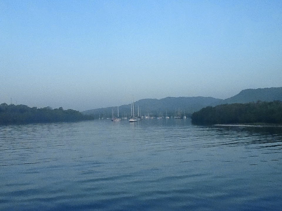
Entrance to Luperon Bay.
First a bit of a history and geography lesson. The Dominican Republic (DR) occupies the eastern portion of Hispaniola, the second largest island in the Antilles. It is shared with Haiti, but they are quite different and have little in common. The DR occupies 2/3 of the land with over 10 million people, at least 3 million live in the capital - Santo Domingo. (BTW my figures are probably off, but it gives you an idea) Dominicans speak Spanish and Haitians speak Creole - a corrupted form of French. Christopher Columbus discovered Hispaniola December 5, 1492 and his brother founded Santo Domingo in 1496, thus Santo Domingo has become the oldest permanently occupied town in the Americas.
We are currently staying in a hurricane hole (inland water for best protection against hurricanes) in the city of Luperon. There are a few thousand of the nicest and most friendly people here. There is a website that gives some info on the town and a video. If you go to the video, don't be shocked - it is poor here, but safe! www.luperon.info
Entrance to Luperon Bay.
You enter the channel and then go down away into the harbor. You can see from in the distance the cruisers that are anchored in the harbor.
Thursday, June 5, 2014
South Side Marina
This is the marina we stayed at while waiting for a front to pass. We have to have a perfect weather window in order to cross to the Dominican Republic; otherwise, it will be another bumpy ride.
The owner of the marina, Bob, caters to the cruisers by taking us to the grocery store and letting us know the weather. He understands, because he use to cruise around to. Well, it's looking like Saturday is the day we head out, at least to cross the Caicos bank. I think the big crossing will be Sunday night. One more overnighter, yeah!!
Turks and Caicos
Recovered
I got a fishing permit in Long Island, so I have been able to try and catch dinner. I have lost 4 lures to the dang barracudas, so when we had a barracuda hanging under the boat for days, I couldn't resist the temptation... I had to teach him a lesson.
And I caught a Mahi!
I couldn't believe this triggerfish wasn't skittish at all. I was feeding him and he probably would have taken it right from my hand.
Mathew Town Dock
Finally found a house we could afford!
This is the government dock/mailboat entrance. What you can't see is the tricky reef on one side that you need to maneuver around. I can't believe that the mailboat that has to be like 94 feet can get in here.
Especially around the sunken ship in the middle. Our tour guide said BASRA, which is Bahamas equivalent of the Coast Guard, searched this boat for drugs and drilled to far and it started sinking. Apparently, the drugs are coming from Haiti.
Great Inagua
Our original plan was to keep going SE to Mayaguana, but we were getting really tired of having our bow in the wind. After looking at the charts, we thought why not go down to see the flamingos in Great Inagua, then to Turks and Caicos. If you look at a map, Mayaguana is SE, but Great Inagua is SW and from there T&C's are NE, so we would finally be able to sail and not beat! It didn't work out that way, but I guess you have to learn sometime. Great Inagua is 40nm east to west and 26nm north to south and almost completely surrounded by reef. It's only settlement is Mathew Town and it the source of raw product for Morton Salt. Over a million tons of it are exported each year - 99.4 to 99.6 percent pure.
Home Sweet Home until the next weather window.
Several miles of salt ponds were they "grow" salt. There is nothing but earth under the salt, no linings. The water dries up and salt forms. Then the conveyor belt dumps them by the truck load and takes them to the mine to be processed and shipped out.
Home Sweet Home until the next weather window.
Several miles of salt ponds were they "grow" salt. There is nothing but earth under the salt, no linings. The water dries up and salt forms. Then the conveyor belt dumps them by the truck load and takes them to the mine to be processed and shipped out.
Inagua National Park
Inagua National park is home to the largest colony of West Indian flamingos in the world, about 50,000 birds that were nearly extinct. Flamingos share their home with a number of native birds, but my favorite is the Bahamian parrot.
Atwood Harbour
We are now past the Tropic of Cancer!? The Tropic of Cancer is as far north as the summer sun travels above the equator in the Northern Hemisphere. Below this line we are in the tropics. What that means for us, I didn't know. The Acklins Island use to be a cotton plantation in the 17th century until they were wiped out by blight. (a disease that makes plants dry up and die) This island is undeveloped and no longer heavily populated. There are few onshore facilities, but the tarpon and bonefishing is said to be some of the best in the Bahamas. Unfortunately, our watermaker pump went out and we needed water. We walked several miles down a road that was apparently being slowly renovated for a resort, until we found the town. The store had maybe ten items in it. No milk, bread, eggs, or water! Finally this rastafarian guy said he would help us out and he drove us to his house where we filled up jugs of water to put in our tank.
On a road trip, we found this cave. Signs were marking the different plants and what they were used for.
I started to go deeper into the cave and turned around and saw these giant alligator. At least I didn't scream this time! (No, it's just a rock)
I was glad it was daylight when the rastafarians helped us out.
On a road trip, we found this cave. Signs were marking the different plants and what they were used for.
I started to go deeper into the cave and turned around and saw these giant alligator. At least I didn't scream this time! (No, it's just a rock)
I was glad it was daylight when the rastafarians helped us out.
Genuis on Board
So, you remember at this point we were waiting for parts to come in so we could fix the saildrive right? Larry and I went beachcombing to find pieces of wood and metal to make some sort of contraption to lift a 800 pound engine up and forward 6 inches. Larry spent hours thinking about and designing a lift with the items we had and.... here is the masterpiece!
And now we are ready to leave Long Island after 5 weeks here. The plan is to go north up around the top of the island and south down the east coast of Long island and southeast towards the Crooked and Acklins islands and stopping in the northeast corner there at Atwood Harbour. (for those of you who are following us on the map) Approximately 123nm and it will probably take 22-24 hrs.
Dean's Hole
A little info on Long Island first:
Nearly 80 miles long and rarely more than 4 miles wide. The northern most point is Cape Santa Maria and the northwestern side is bonefish territory. On the west side of the island, the leeward side, you will find some of the most gorgeous white sandy beaches and secluded coves. The eastern side is rocky, steep, and weather beaten. There is reef along the coast, which was great snorkeling - in calm winds, of course.
Dean's Hole was discovered in 1992. It is a 4,000 foot deep underwater cavern, ranking it the largest blue hole discovered. The hold free dive competitions here and the Free Dive World Championship here every year that is covered by CNN. That is what the white platform in the middle of the picture is for.
Right across from Dean's Hole is Turtle Cove, a beautiful beach and great snorkeling spot.
Nearly 80 miles long and rarely more than 4 miles wide. The northern most point is Cape Santa Maria and the northwestern side is bonefish territory. On the west side of the island, the leeward side, you will find some of the most gorgeous white sandy beaches and secluded coves. The eastern side is rocky, steep, and weather beaten. There is reef along the coast, which was great snorkeling - in calm winds, of course.
Dean's Hole was discovered in 1992. It is a 4,000 foot deep underwater cavern, ranking it the largest blue hole discovered. The hold free dive competitions here and the Free Dive World Championship here every year that is covered by CNN. That is what the white platform in the middle of the picture is for.
Right across from Dean's Hole is Turtle Cove, a beautiful beach and great snorkeling spot.
Serious About Posting
Alright, I think I have figured out how to do this blogging stuff, so from now on, I will start putting more information about the places we are visiting; instead of just a comment and a picture. I will back up a bit and tell you a little about the Bahamas. When Columbus discovered these islands, the Lucayans were there for 150 more years, then because of "white man's" diseases and starvation the islands became desolate. In 1648, the British landed and started to re-populate the islands around Nassau and Eleuthera. The Spanish and the British fought back and forth several times, along with the pirates. Now the Bahamians, a mixture of the British, their slaves and the Spanish are loyal to the Crown. The 700 islands are spread over around 700 miles of ocean and circled within 900 square miles of coral reefs. The surrounding ocean plunges to 10,000 feet and the land is no more than 203 feet at its highest point. The smaller low lying islands are called cays and are pronounced keys and are made up of sand and limestone and are coral based. Andros island is the largest, 100 miles long and 40 miles wide and boasts the third largest barrier reef in the world.
We spent last year cruising the Northern Bahamas - the Abacos, Grand Bahama, Bimini, the Berry islands, Eleuthra, and New Providence(Nassau). This year we visited the Southern Bahamas - Exumas, Long Island, Acklins, Great Inagua. We are now in Turks and Caicos waiting for a weather window to cross a very deep ocean into Dominican Republic.
I hope we have better food in the DR - Sheep Tongue? I didn't care for the Bahamian Cuisine.
We spent last year cruising the Northern Bahamas - the Abacos, Grand Bahama, Bimini, the Berry islands, Eleuthra, and New Providence(Nassau). This year we visited the Southern Bahamas - Exumas, Long Island, Acklins, Great Inagua. We are now in Turks and Caicos waiting for a weather window to cross a very deep ocean into Dominican Republic.
I hope we have better food in the DR - Sheep Tongue? I didn't care for the Bahamian Cuisine.
Friday, May 9, 2014
Getting Mail in the Bahamas
After looking at the cost involved flying to the states and renting a car, then the hotel; it turned out to be cheaper to just have it mailed. The mailboat comes once a week bringing food, mail, and people. It is crazy and there really isn't a procedure on how to get your mail. You just have to be there when it comes and hope nobody grabs your package before you do.
This lady couldn't figure out why I was holding my "book" up in the air and was shocked that it could take pictures. She poised and asked me to take her picture and look at it.
The forklift empties all the boxes in piles and when you find your package, you pay a lady the shipping fee and off you go.
This lady couldn't figure out why I was holding my "book" up in the air and was shocked that it could take pictures. She poised and asked me to take her picture and look at it.
The forklift empties all the boxes in piles and when you find your package, you pay a lady the shipping fee and off you go.
Wednesday, May 7, 2014
A Day at the Beach
They even have rainbows!
Snorkeling on the Reef
Met some nice people who showed us a beautiful snorkeling spot. Saw more fish and coral than when I went diving in Hawaii!
Subscribe to:
Posts (Atom)